Government & Defense Solutions
Trusted by Government Entities
REscan partners with local, state, and federal agencies, including the Department of the Air Force through multiple SBIR Phase I and II R&D contracts. Our AI-driven digital twin technology transforms raw spatial data into actionable intelligence, supporting mission-critical operations, base-resiliency, and facility management. We’re committed to bringing the best in digital twin technology to government entities.


AI-Enhanced Decision Making
REscan’s technology accelerates decision-making for mission & operations by providing unprecedented insights for operational and spatial planning across public infrastructure, bases, and sensitive sites. We analyze scanned environments, enabling the creation of semantic maps, automatic asset identification, and anomaly detection.

Fully Interoperable & Future Ready
REscan’s system works with your existing data and workflows. We ensure maximum compatibility by ingesting and processing all standard point clouds, tessellated meshes, and constructive geometry formats. We then enhance your previously captured data with semantic labeling, object detection, and predictive analytics.

AI-Enhanced Situational Awareness & Training
REscan’s AI-enabled digital twins provide an exact replica of any space, ideal for AR/VR training and mission rehearsal. Semantic overlays highlight critical infrastructure, access routes, and equipment. With features like real-time wayfinding and AI-derived insights our digital twins enhance situational awareness, emergency planning, and scenario-based training. Compatible with all leading head-mounted devices.
REscan’s Government Codes:
UEI:
DUNS:
CAGE:
SBA SBC ID:
FKF1NEJ91XL5
080156019
8H4C9
001714779
UEI: FKF1NEJ91XL5
DUNS: 080156019
CAGE: 8H4C9
SBA SBC ID: 001714779
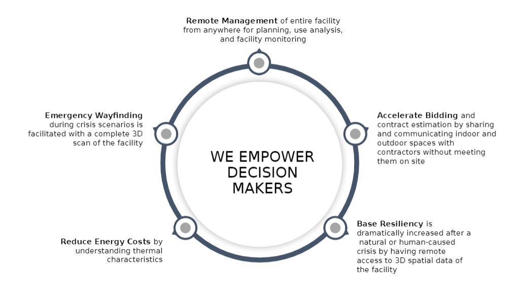
WE EMPOWER DECISION MAKERS

Remote Spatial Awareness of select (or entire) facilities from anywhere for response planning, use analysis, and facility monitoring
Accelerate Bidding and contract estimation by sharing and communicating indoor and outdoor spaces with contractors without meeting them on site
Base Resiliency is dramatically increased after a natural or human-caused crisis by having remote access to 3D spatial data of the facility
Reduce Energy Costs by understanding thermal characteristics
Emergency Wayfinding during crisis scenarios is facilitated with a complete 3D scan of the facility